How BeZero’s field research in Uganda is helping refine biomass estimates
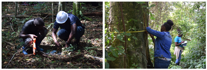
Innocent Kasekendi softly taps the hammer against the head of the aluminum nail, gently driving it into the Prunas africana tree, the hand-stamped tag fluttering below identifying it as BZC 088. The tree’s precise location, standing in a carefully demarcated 50 m x 50 m plot, means that at some point in the future it can be found again, measured and recorded. The process is being repeated for all the other trees within the plot, and for many more similar plots throughout Uganda's Kibale National Park, and beyond.
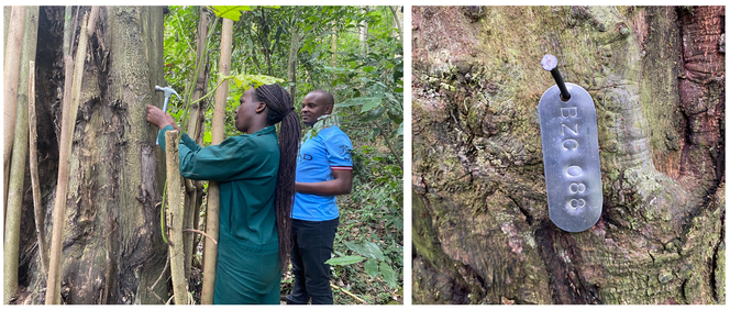
Tagging trees after identifying the species and measuring the diameter at breast height (DBH) and height.
Working with the Uganda Wildlife Authority, Innocent and fellow student Vincent Munguleni are measuring the diameters and heights of trees to establish a better understanding of the vegetation’s structure, species composition and amount of biomass stored. Knowing the exact location of the plots allows them to be compared with satellite imagery, a process of ground truthing that is essential for calibrating remotely-sensed data. Setting the baseline will enable change over time to be assessed and related to other environmental variables, such as changes in the climate.
BeZero’s Dr Sadadi Ojoatre, himself Ugandan, is supervising the field work and reporting progress, even though doing so means a 40-km round trip to find the nearest mobile signal. The biomass sampling is supporting the wider project’s aims, which include collection of environmental DNA (eDNA) samples, the first batch of which are currently being sequenced. Taken together, these ground-based data will improve understanding of how carbon is sequestered and stored by environments, and how this relates to biodiversity and levels of human-induced stress.
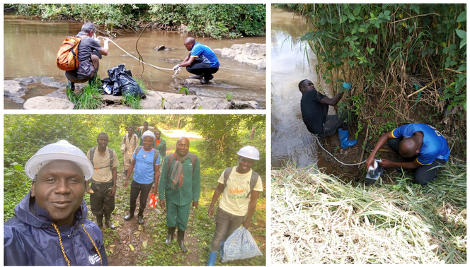
Top left: eDNA water samples collected from the river Mpanga in Kibale National Park, and bottom left: soil samples from the biomass plot.
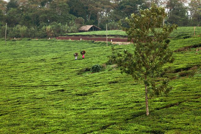
It’s hot, hard work but not without its immediate rewards. Kibale is a breathtakingly beautiful place: it’s a globally important centre for many rare and endangered species, monkeys chatter from the trees above, and the research team also needs to be ever vigilant for the presence of elephants. Establishing the biomass sampling plots will provide a yardstick for the way that carbon stores are impacted by a dynamically changing climate. The eDNA data could reveal the presence of otherwise cryptic species and yield insights into wider ecosystem health.
The juxtaposition of the low-tech botany and tree tagging and cutting edge genetic analysis, and of the laborious ground-based measurements with the machine learning analysis of satellite images, is intellectually thrilling. Bringing these technologies together in the same place will refine our ability to quantify change in both carbon and biodiversity, helping address the twin environmental challenges of our time. But the practical outcome is what really counts: improving market transparency will really hit the nail on the head.