Earth Observation in the Voluntary Carbon Market
Contents
- Earth observation > remote sensing
- Half the story
- Matter of perspective
- Powerful satellite tools offer partial insights
- Truthing lies closer to the ground
Please note that the content of this insight may contain references to our previous rating scale and associated rating definitions. You can find details of our updated rating scale, effective since March 13th 2023, here.
The VCM contains thousands of projects all claiming to deliver the same outcome. Each project relies on a technological, or nature-based, approach to avoid or remove carbon emissions. Often projects avoid and remove emissions simultaneously.
Rating the quality of carbon credits - the likelihood that each delivers an equivalent tonne of carbon dioxide avoided or removed - involves an understanding of policy, science, and financial theory. It is a new frontier for analysts.
Whether developing, investing in, transacting, or retiring carbon credits, market actors need more powerful tools and information infrastructure, to make better and faster decisions.
Effective and useful analysis relies on BeZero Carbon having a transparent approach and command of myriad disciplines.
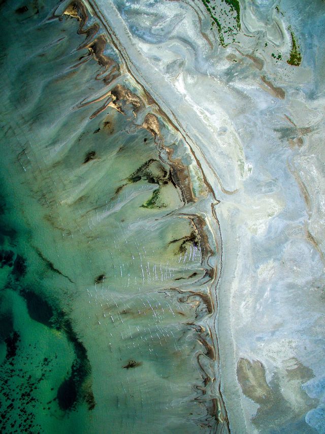
Perhaps the most hyped, and sometimes contested, tool for risk assessment is the application of remote sensing technologies for nature-based sectors such as agriculture, blue carbon, forestry, and soil carbon - sectors that account for some 50% of outstanding credits in the VCM.
Earth observation > remote sensing
The term ‘Earth observation’ is often used synonymously with remote sensing, and especially satellite remote sensing.
We take a more holistic view, considering Earth observations to be inclusive of a wider range of information collected about our planet, from spaceborne technologies down to in situ ground measurement, and a great deal in between.
Equally important is geoinformatics: the art of making sense of this diverse array of spatial information, understanding how uncertainty propagates, and drawing conclusions for a particular purpose - in this case, risk assessment and project monitoring in the VCM.
The promise of Earth observation is to widen, and partially automate, the evidence base for carbon project efficacy. How we integrate Earth observations into our ratings framework, as well as broader applications across the VCM, is a big focus for BeZero research.
We are mindful to ensure we make intelligent use of these data, which means avoiding one-size-fits-all tools, and never presenting the findings as a panacea.
Great stead is being placed in emerging technologies for the remote estimation of forest biomass. Some of the visuals can be extremely impressive. For example, tree models derived from terrestrial or near-surface laser scans, rendered in technicolour, bring a vivid reality to a discipline previously confined to research labs.

Image 1. Cylindrical tree models fitted to point clouds from terrestrial laser scans. Credit: Dr Eric Casella, Forest Research agency of the Forestry Commission, UK.
Such technologies could, in time, revolutionise the accuracy, transparency and timeliness of reporting and issuance in some VCM sectors.
However, carbon projects are local, numerous and diverse, spanning a wide range of methodologies, ecosystems, and social and political contexts.
For Earth observations to facilitate transparency and scalability in the VCM, technological wizardry matters, but so too does ground truthing, ecosystem and market coverage, and wider context across a range of risk factors.
Half the story
Earth observation is applied mainly in the purview of nature-based projects, while the VCM as a whole is much broader.
According to BeZero analysis, the Nature Based Solutions sector group currently comprises 15% of projects in the VCM, but contributes 51% of outstanding VCM credits. So while significant, Earth observations aren’t widely applicable to most accredited carbon projects by number, and half of the credits outstanding.
Within the 15% of projects that are nature based, certain sectors are more amenable to remotely sensed inference of carbon change than others. Where vegetation is well studied, relatively homogeneous in time and space, and where a majority of carbon is stored above ground, remotely sensed data can readily inform certain risk factors relevant to a project’s success.
Conversely, where creditable changes are expected to be gradual, or played out across sparse open canopies, subject to large-scale natural disturbances such as fire, or where soils are the majority carbon store, complexities compound. Here, the need for more diverse Earth observation data and systems understanding is amplified.
Tropical dry forest types, for example, can be more challenging to monitor remotely compared with denser, wet forests. This is partly because a high proportion of the carbon is stored below ground, but also because highly seasonal, open tree canopies nest within the grain size of freely available satellite imagery.
Commercial imagery provides incredible spatial detail, but costs can be prohibitive for long-term monitoring at scale.
Similarly, Afforestation, Reforestation and Restoration projects require timely, high resolution data on vegetation composition and structure, combined with grounded understanding of how carbon is sequestered gradually over time (cf. more abrupt carbon stock changes in the Avoided Deforestation sub-sector).

Chart 1. The percentage of projects (upper) and outstanding credits (lower) in each sector group, as defined by the BeZero Carbon Sector Classification System. Nature Based Solutions (NBS) comprise 15% of projects in the VCM; stacked bars show that 13% are in the Forestry sector (of which 3.6% Afforestation, Reforestation and Restoration, 2.5% Avoided Deforestation, and 7.1% Improved Forest Management). NBS projects contribute 51% of outstanding VCM credits; 45% are in the Forestry sector (of which 3.4% Afforestation, Reforestation & Restoration, 24% Avoided Deforestation, and 18% Improved Forest Management).
In sum, Earth observations will enhance the utility and analytical depth of the BeZero Carbon Rating for a substantial section of the market, but ongoing research and development is essential to realise the potential. The first step is to take stock of all the different satellite imagery and other remote sensing technologies, analytical tools, and field data available.
We want to ensure BeZero’s approach to researching the efficacy of Earth observation informs ratings for all nature-based projects, as well as other sector groups where landscape changes or trace gas flows could be linked with project activities.
Earth observation cannot, however, be applied to all sectors of the VCM.
Matter of perspective
As a rule of thumb, the further you (or your measurement device) are from an ecosystem, the less richly and accurately its attributes can be measured. Conversely, the closer you are, the narrower your field of view.
For example, with feet on the ground, a terrestrial laser scanner captures vegetation structure with millimetre accuracy, while botanists and soil scientists survey the same plots.
On drones or aircraft, similar lidar technologies can be deployed for greater coverage, but the spatial resolution might reduce to tens of points per square metre, and interpreting these data requires a grounded understanding of the forest structure and ecology.
Spaceborne lidar is relatively new, and provides partial global coverage with high frequency (but time limited) data collection, but at still coarser spatial resolution.
Currently, it is not possible to accurately benchmark, let alone track, ecosystem carbon using satellite data alone. Doing so requires detailed information on vegetation structure (for volume), species composition (for biomass and carbon concentration), and especially for boreal or tropical dry forest, mangrove, grassland or peatland projects, local measurement of soil organic carbon and a sound understanding of how carbon cycles, above and below ground, seasonally, and over longer time periods.
Powerful satellite tools offer partial insights
In a breakthrough for the global measurement of vegetation structure, the Global Ecosystem Dynamics Investigation (GEDI), launched in 2018, collects daily information relevant to forest height, canopy cover, and vertical structure. This is an incredible resource, but it is no panacea.
Energy requirements for spaceborne lidar limit data collection to a small fraction of the Earth’s surface (currently <4%), mission durations are limited (GEDI is scheduled to end early next year), and in some ecosystems forest height estimates can have significant errors (for example due to moisture or steeply sloping ground).
Creating biomass products from spaceborne lidar requires a network of ground-level and airborne data, yet sparse and unrepresentative coverage means considerable variability in model performance, geographically and among ecosystem types.
Spaceborne radar (using radio instead of laser waveforms to measure distance) can also inform estimates of vegetation structure, is impervious to weather conditions, and has global coverage for example on Germany’s TanDEM-X and ESA’s Sentinel-1 satellites.
Both of these radar systems use relatively short wavelengths, meaning that backscatter (the signal returning to the radar antenna) saturates in dense forests - the data become less differentiated where aboveground biomass exceeds about 50 tonnes per hectare (90 tCO2e if released). For context, aboveground biomass of 300 t/ha is typical for wet forests in Africa and Southeast Asia, and around 200 t/ha in the Neotropics.
Some of these limitations look set to be mitigated by new radar missions planned by ESA and NASA for launch in 2023, which will use longer wavelengths capable of penetrating deeper through dense forest canopies.
For global coverage, gridded biomass estimates are typically modelled at coarser spatial and/or temporal resolutions than some of the underlying data, in order to fuse information from different sources: radar and/or lidar, and multispectral imagery (similar to a traditional camera but capturing a wider spectrum of light), alongside other controls.
Currently, global biomass maps lack agreement, or else tend to underestimate aboveground biomass in the wet tropics, while overpredicting elsewhere.
As noted above, understanding uncertainty in these models, and indeed training them in the first place, requires extensive ground measurement.
Truthing lies closer to the ground
To estimate ecosystem carbon across a landscape or seascape, a combination of in situ, near-surface, airborne and spaceborne measurements provides the optimal framework for training models, and understanding uncertainty at scale.
Through this framework, we can distinguish signal from noise over large areas, target resources efficiently, and assess emissions avoided or sequestered within known bounds of accuracy.
Ideally, all nature-based projects in the VCM would publish repeated plot measurements, including terrestrial laser scans and aerial surveys. Alternatively, a buyer or intermediary could commission such measurements (given access rights). This might be feasible for a small subset of projects, but the costs of scaling to the whole VCM are restrictive.
Some carbon projects have teams on the ground, establishing and remeasuring monitoring plots (usually by tape measure and botanist). These data may be shared with the project accreditor, but they are rarely in the public domain, at least not in sufficient detail as to allow independent scrutiny or spatial matching with remotely sensed information.
Similarly, national forest inventories tend not to be widely available, while research scientists who have spent months or years collecting data in the field can be hesitant to share these data beyond collaborative circles (e.g. for a scientific paper or grant proposal).
All told, the global availability of in situ, near-surface and airborne data on forest composition, structure and carbon is sparse, and skewed towards certain geographies, ecosystem types, and carbon pools (typically aboveground live carbon, temperate latitudes, and some wet evergreen forests in the tropics).
Given the crucial role of ground truthing in realising the potential of Earth observation in the VCM, BeZero Carbon is exploring ways to increase access to, and coverage of, above and below ground field measurements.

Image 2. Researchers surveying forest carbon in Uganda. Credit: Dr Aida Cuní Sanchez, Norwegian University of Life Sciences, plot network advisor to BeZero Carbon.
We are currently trialling the BeZero Carbon Fieldwork Awards, to facilitate data collection and analysis by researchers in local institutions, especially in tropical regions. The awards will be coordinated by Dr Camila Silva, who joins BeZero Carbon from Lancaster University and the Amazon Environmental Research Institute, previously with Brazil’s National Institute for Space Research.
Priorities for awards will be driven by local need and capacity building, and optimised to address data gaps systematically, across ecosystem types and carbon pools, and how these map onto sectors and sector-trends in the rapidly growing VCM.