
Seeing the trees from the wood
BeZero’s Geospatial and Earth Observation team have tirelessly built the world’s most comprehensive dataset of independently audited project boundary data, to help our users see the trees from the wood.
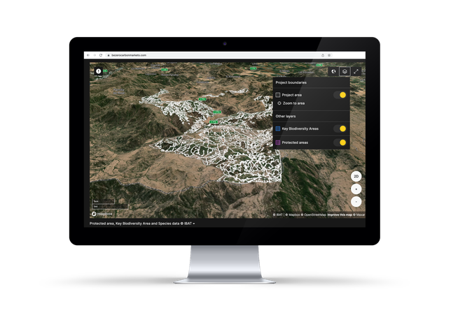
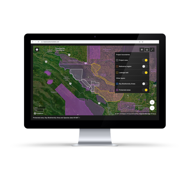
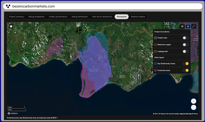
Geospatial and Earth Observation analysis informs all nature based ratings. BeZero Carbon Markets platform users can access maps for over 100 nature based projects, with project areas, reference regions, leakage belts, as well as Key Biodiversity Areas and Protected Areas provided by IBAT.
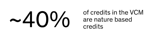
The Voluntary Carbon Market provides a means for companies, countries and consumers to invest in the planet by contributing to conservation and restoration projects.
Source: BeZero Carbon database
However, it’s hard to act with confidence in the market if you don’t even know where the projects are
Source: BeZero Carbon database
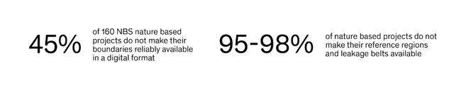
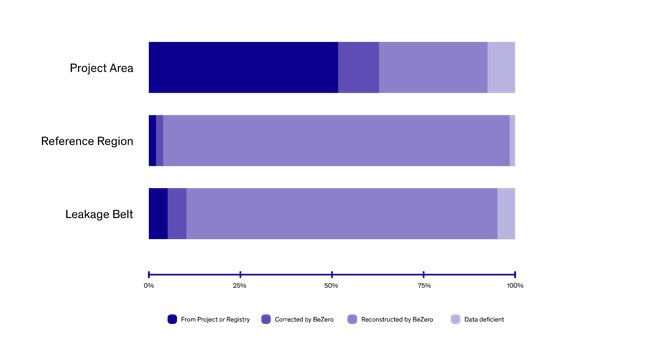
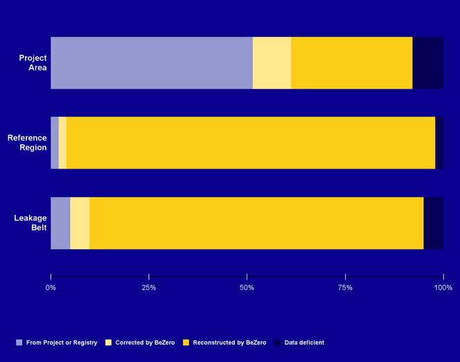
BeZero’s Geospatial and Earth Observation team have corrected and rebuilt project boundary data for over 100 Nature Based projects, the world’s largest audited dataset for project boundary data.
Our Geospatial and Earth Observation team is made up of remote sensing and machine learning experts, geostatisticians and field ecologists with over 200 academic articles in publications like Nature and Science, and over 10 thousand citations in the scientific literature.
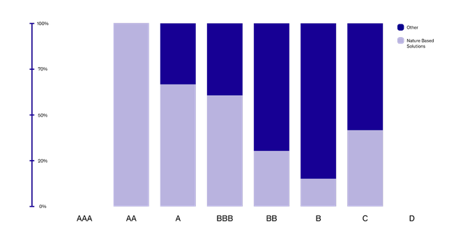
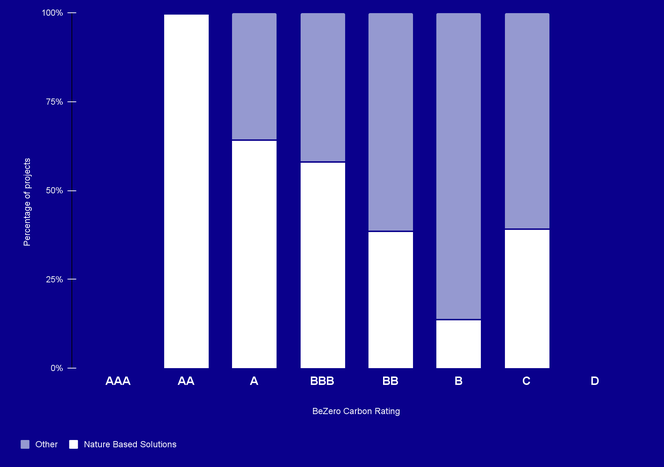
Geospatial data and Earth Observation techniques inform our ratings coverage of over 100 nature based projects, which make up 100% of AA ratings and 64% of A ratings of more than 300 project ratings on our platform
The team looks at change detection, natural hazards, statistical controls and carbon stocks, with analysis particularly relevant to additionality, over-crediting, non-permanence and leakage risk.
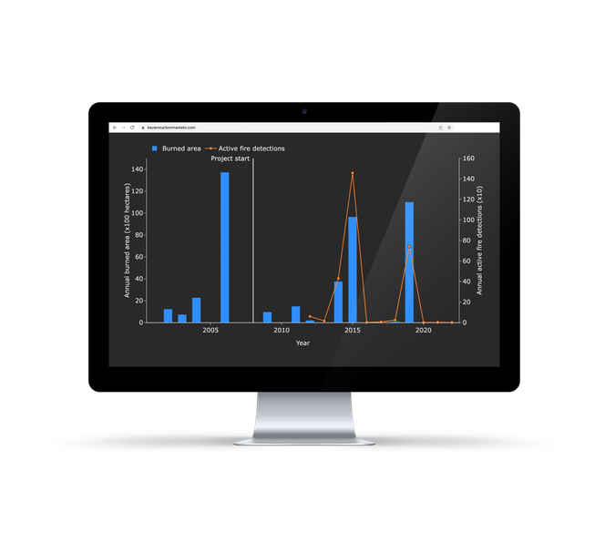
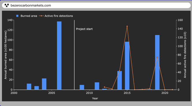
An example of Natural Hazard analysis driving non-permanence risk. Burned area (bars) and active fire detection (lines) before and after the project start date. Burned area captures the spatial extent of burning, while active fire detections reflect the count of hot pixels at satellite overpass. Data from NASA (MODIS MCD64A1 and VIIRS VNP14IMGML). Available on BeZero Carbon Markets.
Users of the BeZero Carbon Markets platform can find interactive map with Project Areas, Reference regions and Leakage Belts for over 100 nature based projects
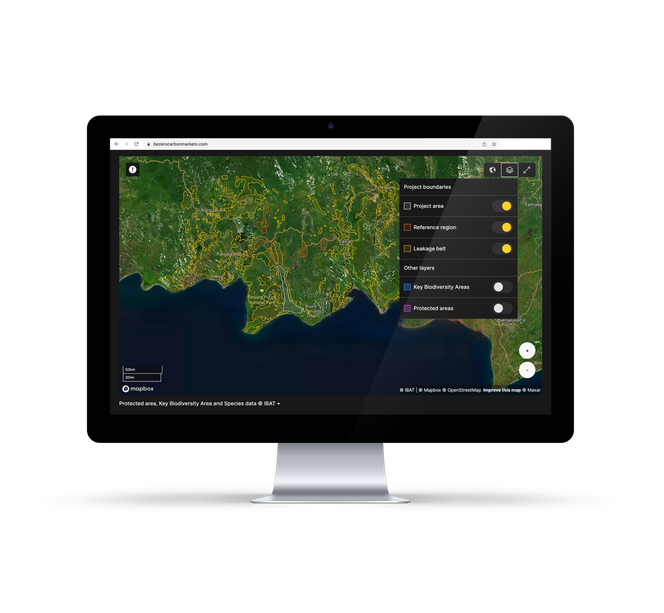
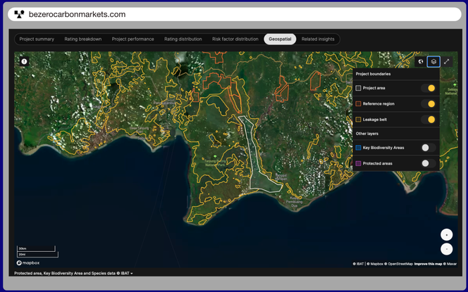
Example of project boundaries available for all nature based projects on BeZero Carbon Markets platform.
Through partnership with the International Biodiversity Assessment Tool Alliance (IBAT), users can also see Key Biodiversity Areas and the World Database on Protected Areas
For more information on our Geospatial and Earth observation research and capabilities, as well as data and analysis available on our platform, including drought analytics, fire monitoring, carbon stock density, forest change detection and dynamic baselines, get in touch using the form below.